Last Updated on 31/01/2026
People call Ladakh Moonland or the last Shangri-La. These phrases sound dramatic, almost exaggerated, until you actually travel through the region. Then they start to make sense.
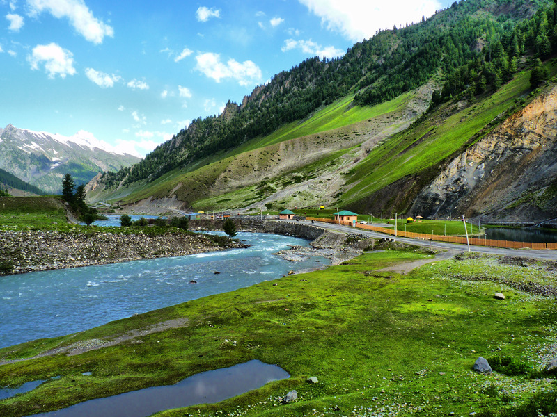
Ladakh lies beyond the main Himalayan ranges, on the edge of the Tibetan Plateau. Rain rarely reaches here. High mountains block moisture-heavy clouds, leaving the land dry, open, and harsh. Most of what you see is rock, sand, and wind-shaped terrain. Green patches exist, but only where glacial meltwater allows life to survive. Villages form wherever water flows. Beyond that, there is mostly silence and stone.
The landscape does not try to impress. It simply exists — vast, bare, and uncompromising. The colours stay muted for long stretches: grey, brown, pale yellow. Then suddenly, a narrow valley opens up, and you see barley fields, apricot orchards, and clusters of whitewashed homes clinging to the mountainsides.
Since 2019, Ladakh has been administered as a separate Union Territory of India. Strategically, culturally, and environmentally, it holds enormous importance. But for travelers, Ladakh is something else entirely — a place that forces you to slow down, observe, and adapt.
Why Ladakh draws serious travellers
- Extreme landscapes that feel raw and untouched
- Ancient Buddhist and Islamic traditions existing side by side
- Old trade routes once linking Central Asia, Tibet, and Kashmir
- Weather and altitude that demand physical and mental adjustment
- Remote villages where daily life still follows old rhythms
Here are some visiting places in Ladakh listed below:
Drass
Drass sits quietly along the Srinagar–Kargil highway, beside the Drass River. It rarely makes headlines, yet it is known across India as one of the coldest inhabited places in the country.
Winter here is not symbolic — it is severe. Snow piles up, roads close, and life slows to survival mode. Even during summer, mornings carry a sharp chill. Travel planning around Drass always revolves around weather windows.
The village hosts a transit camp and a strong military presence due to its proximity to sensitive border zones. A PWD rest house and a few small guesthouses serve travelers in season. Across the road, the modest Rahi Tea Stall proudly displays a sign: “Hot Tea Available Anytime.” In a place like Drass, that promise actually matters.
Local speech reflects the environment. The word Hambabs means snowfall — not as a poetic idea, but as a daily occurrence. Drass also serves as a base for treks towards Suru Valley and Sanku, attracting hikers who prefer quiet trails over popular routes.
Driving toward Kargil, the road traces the river through a narrowing valley. Just beyond Drass, four 7th-century Buddhist rock carvings appear beside the highway — Maitreya, Avalokiteshvara, and symbolic figures carved straight into stone. They stand silently against centuries of wind, snow, and history.
Beyond Tashgam, the terrain tightens. Mountains close in, loose rock carpets the slopes, and villages appear high above the road, built on narrow terraces. Near the Suru Valley junction, a bridge crosses into restricted military territory — access is prohibited, and signage leaves no ambiguity.
The road then winds through Kharbu and Channigund, before finally opening into the broader valley of Kargil.
Suggested Tour:
Kargil
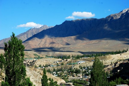
Kargil rests at the meeting point of the Drass and Suru rivers, not far from where the Indus begins its long journey. In earlier centuries, this location made Kargil a natural trading post. Caravans passed through carrying goods between Central Asia, Tibet, Kashmir, and the Indian plains.
That era has faded. Borders hardened, routes closed, and commerce shifted. What remains today is a town that serves mainly as a logistical halt between Srinagar and Leh.
Most travelers stop here for a night — sometimes two — to rest, refuel, and adjust to altitude. Hotels are basic, food is simple, and medical facilities are functional rather than elaborate. Early morning, buses and shared taxis roll out toward Leh, often before sunrise.
For trekkers heading into Zanskar Valley, Kargil becomes more than just a stop. It is the last dependable supply point. Beyond this, shops thin out, availability becomes uncertain, and self-sufficiency matters. Anything forgotten here often cannot be replaced.
Alcohol is hard to find, and public consumption is discouraged. This is less about regulation and more about respect for deeply rooted religious values.
The dominant dialect here is Purik, closely related to languages spoken across the border in Baltistan. Most residents follow Shia Islam, shaping daily routines, dress, architecture, and public life. Irrigation governs survival. Meltwater from glaciers is distributed carefully through community-managed channels. Villages divide themselves into small family groups to ensure fairness. Without this discipline, agriculture would fail.
In May, the town hosts a traditional archery festival, drawing participants from surrounding valleys. For a few days, competition, celebration, and community pride replace the usual quiet pace.
With a population now well above 15,000, Kargil remains Ladakh’s second-largest town after Leh. Apricot trees line irrigation channels, and poplars sway above terraced fields — small islands of green surrounded by mountains.
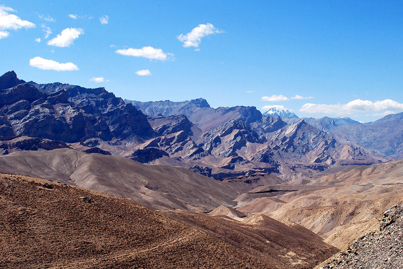
Around Kargil
Passes, Villages, and Isolated Valleys
The terrain around Kargil is rugged and politically sensitive. Mount Kala Pahar, rising above the town, was part of contested territory until the 1971 conflict. Even today, several routes remain restricted.
To reach Leh, travelers cross Namika La and Fatu La — high-altitude passes where weather changes quickly. Landslides, snow, and wind are part of the journey. Even modern roads cannot fully tame this terrain.
Perhaps the most fascinating region nearby lies lower along the Indus — the villages of Dha, Hanu, Darchik, and Garkon, home to the Brokpa community. Their features, clothing, customs, and language set them apart. Linguistically, their speech blends Sanskrit, Persian, and older Indo-European roots.
Isolation has preserved their traditions. Marriages mostly remain within the community. Governance rests with village councils. Every July, harvest festivals fill the valleys with music, dance, and ritual — brief moments when centuries-old culture surfaces openly.
Garkon, about 80 km from Kargil, remains one of the more remote settlements and requires careful planning to reach.
Shergol
Shergol lies quietly along the Wakha River, 33 km from Kargil, hidden behind a rocky ridge. From the road, the village is barely visible.
A small monastery clings halfway up the mountainside. Two monks and a single nun maintain the complex. Some rooms are carved straight into stone, more cave than chamber. Below, a village of around 35 households continues agricultural routines largely untouched by tourism.
There is little here for hurried travelers. But for those willing to pause, Shergol offers stillness — and perspective.
Mulbekh
Monasteries, Palace, and Living Tradition
Seven kilometres beyond Shergol lies Mulbekh, once ruled by Raja Chalon. Remnants of his palace still overlook the valley.
Above the village, two monasteries — Serdung and Gandentse — cling to steep slopes. The climb is physically demanding, especially before full acclimatization. Yet the view over Wakha Valley makes the effort worthwhile.
Monasteries here often remain closed if monks are absent. Asking in the village first saves disappointment. When open, the experience is quiet, personal, and far removed from crowded monastery circuits.
Mulbekh’s Shuba harvest festival is deeply rooted in local belief. During this time, the village oracle performs rituals that attract visitors from surrounding valleys.
Monastery etiquette matters here:
- Shoes off
- Voices low
- No touching sacred objects
- Always walk clockwise around Chortens
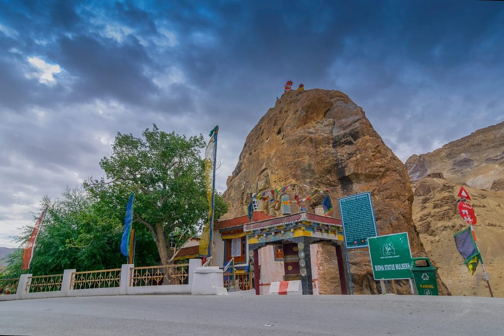
Chamba Statue
Just beyond Mulbekh stands a towering rock-carved statue of Maitreya Buddha, believed to date back to the Kushan era. Weathered yet dignified, it has watched over the valley for nearly two thousand years.
A small modern shrine now partially shelters the statue, though it also obscures some of the original carving.
Gel
Gel is not easy to reach, and that may be its greatest protection.
The village clings to steep slopes above the Wakha River. Life unfolds slowly here. Visitors are rare. Initial suspicion is natural, but curiosity often follows. Traditional tools, crafts, and farming methods remain central to daily life.
Road construction is slowly bringing Gel closer to the outside world, but for now, it remains one of those places where time still feels suspended.
Namika La & Fatu La
Beyond Mulbekh, the road climbs steadily toward Namika La (3,718 m). The land opens up, wind sweeps across open ridges, and small villages appear scattered across barren slopes.
Further ahead lies Fatu La (4,094 m) — the highest pass on the Srinagar–Leh highway. Wind, cold, and thin air define the crossing. About 15 km beyond, Lamayuru Monastery emerges dramatically from eroded cliffs, one of Ladakh’s most striking sights.
Basgo
Above the road at this small town is the heavily devastated Basgo Fort. Basgo Gompa is worth a visit on account of its Buddha figures but, unfortunately, its wall painting have been badly water damaged. The first Gompa has a two-storey high golden Chamba statue in ‘European’ sitting posture. Smaller Chamba statues stand in front of the figure of the white clothed Chamonada. One of the three monks who live below the Gompa in a small house will have the Gompa key.
Nimmu
Near Nimmu village, four Chortens stand quietly among green fields. Just ahead, the Zanskar River meets the Indus, slicing through dramatic rock walls. From this point, Leh lies only 35 km away, marking the final approach after days of mountain travel.

 Call
Call WhatsApp
 Enquiry