Last Updated on 10/07/2026
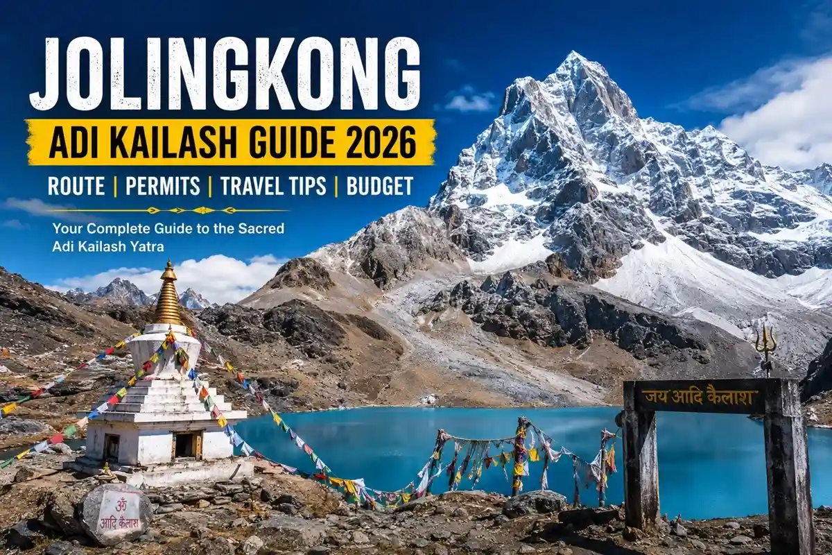
Jolingkong isn’t a town — it’s a high-altitude meadow in the Kumaon Himalayas where the Adi Kailash peak suddenly fills the sky in front of you. This is the base for the Adi Kailash darshan, sitting in the Pithoragarh district of Kumaon. Here you’ll find the Shiva-Parvati temple, the sacred Parvati Sarovar, and Gauri Kund together at one of the remotest corners of Uttarakhand.
Quick Overview:
- Jolingkong altitude: Approximately 4,400–4,600 m above sea level.
- Distance from Gunji: Around 30–45 km by 4×4 jeep (varies by route and source).
- Adi Kailash peak elevation: Commonly reported at 5,945 m.
- Best time to visit: May–June and September–October.
- Permit requirement: An Inner Line Permit (ILP) from Dharchula is mandatory.
- Travel advisory: Access may be suspended seasonally or due to weather conditions, including the current suspension.
Where Is Jolingkong, and What Do You See There?
Jolingkong is the last vehicle-accessible point on the Adi Kailash route, reached via Gunji and Kuti village, and is where most pilgrims complete their Adi Kailash darshan. Vehicles generally get you close to the darshan area; a short walk of roughly 20–45 minutes may still be needed depending on road, snow, and parking conditions that season.
At Jolingkong, you’ll find:
- Adi Kailash peak (also called Chhota Kailash or Jonglingkong Peak) — commonly reported at approximately 5,945 m, though some geographic references cite higher figures due to naming and mapping differences. It is traditionally regarded as one of the sacred Panch Kailash peaks.
- Parvati Sarovar — a glacial lake at the mountain’s base, with water bodies traditionally associated with Gauri Kund nearby
- Shiva-Parvati temple — a small shrine on the lakeshore
Visitors are generally advised not to bathe in these sacred waters and to follow local instructions on site.
Jolingkong vs Nabhidhang vs Kailash Mansarovar
People often mix these up. Quick difference:
| Destination |
What You See |
Permit |
| Jolingkong |
Adi Kailash peak, Parvati Sarovar |
ILP (Indian citizens) |
| Nabhidhang |
Om Parvat “Om” snow formation |
ILP (Indian citizens) |
| Kailash Mansarovar |
Mount Kailash, Tibet |
Chinese visa + lottery |
Most itineraries cover Jolingkong and Nabhidhang together, on separate days from a Gunji base.
Jolingkong Route and Distance
Only locally authorised, registered 4×4 vehicles operate beyond Dharchula under current permit rules — confirm exact vehicle requirements with your operator before departure, since checkpost rules can change.
| Segment |
Distance (approx.) |
Notes |
| Kathgodam to Dharchula |
~300 km |
Paved road |
| Dharchula to Gunji |
~90–100 km |
Restricted zone, 4×4 only |
| Gunji to Jolingkong |
~30–45 km |
Route measurement varies by source |
| Final walk to viewpoint |
Variable |
~20–45 minutes |
Road conditions near Kuti and the final Jolingkong stretch shift quickly with weather — always keep a buffer day in your plan.
Best Time to Visit Jolingkong
- May–June: Pre-monsoon window, generally the most stable and popular
- July–August: Monsoon period; travel is generally not recommended and permits may be suspended, as is currently the case in 2026
- September–October: Post-monsoon clarity, second-best window
- November–April: Region is typically closed due to heavy snowfall
Treat closing dates as tentative — they depend on snow and administration notices, not a fixed calendar.
ILP Permit Process
Jolingkong lies in a restricted border zone, so every Indian traveller needs an Inner Line Permit from the Dharchula SDM office.
- Carry ID proof copies, passport photos, and a medical fitness certificate
- Apply at the Dharchula SDM office, or through a registered operator
- Permits are checked again at the Gunji checkpost — carry originals
- Foreign-national access is highly restricted; verify current eligibility with the district administration before planning
Processing time can vary, so confirm document requirements and timelines with your operator in advance.
Weather and Packing
Temperatures can fall well below freezing at Jolingkong, especially at night, and conditions vary significantly by month and weather. Pack for genuine winter conditions even in the May–June “warm” window:
- Thermal layers plus a windproof/down jacket
- Sturdy trekking shoes with ankle support
- Sunglasses and high-SPF sunscreen
- Power bank — charging facilities are limited and unreliable beyond Gunji
- Woolen cap, gloves, hot water bottle
Do not self-medicate for altitude sickness — discuss preventive medicine with a qualified doctor before you travel.
Accommodation, Transport and Senior Citizen Tips
Beyond Dharchula, accommodation is mainly basic KMVN guesthouses and homestays at Gunji and Nabi rather than conventional hotels. Meals are simple home-cooked Kumaoni thalis.
Vehicle access beyond Dharchula is regulated; travellers generally use locally authorised high-clearance vehicles after permit formalities. Helicopter or aerial tour services from the Pithoragarh region may be offered seasonally — verify current routes, permissions, and schedules directly with operators before booking, since availability isn’t guaranteed year-round.
For senior citizens: a helicopter option can reduce long road hours but does not remove high-altitude health risk, since it shortens acclimatisation time. Medical clearance and the operator’s fitness requirements matter more than the mode of transport.
Budget (Indicative Only)
| Component |
Approx. Range (₹) |
| Road package (8–10 days) |
30,000 – 50,000 |
| Helicopter darshan package |
60,000 – 90,000 |
| ILP/permit-related charges |
500 – 1,500 |
These are indicative figures checked in July 2026, not official fares. Actual cost depends on departure city, duration, inclusions, and taxes.
Safety and Common Mistakes
- Skipping acclimatisation at Gunji is the biggest cause of Acute Mountain Sickness (AMS) on this route — rest at least one night before ascending further
- Assuming private cars work beyond Dharchula — they generally don’t under current rules
- Not carrying cash — mobile network and UPI are limited and inconsistent past Gunji
- Under-packing for cold, even in the “warm” season
- Not checking current permit status before travelling — as the 2026 monsoon suspension shows, access can change with little notice
Descend immediately if AMS symptoms worsen, and always confirm the latest district advisory before departure.
Conclusion
Jolingkong rewards travellers who plan around conditions, not around assumptions. Confirm your ILP status, build in a Gunji acclimatisation night, and favour the May–June or September–October windows. This Chhota Kailash journey remains the most accessible Panch Kailash pilgrimage from within India — just check the live status before you commit dates.
FAQs
Q-1: What is the altitude of Jolingkong?
Approximately 4,400–4,600 metres; figures vary slightly by source and exact location.
Q-2: What is the height of Adi Kailash peak?
Commonly reported around 5,945 metres, though some references cite higher figures.
Q-3: How far is Jolingkong from Gunji?
Roughly 30–45 km by 4×4, depending on route measurement.
Q-4: Is trekking required to reach Jolingkong?
No — vehicles reach close to the viewpoint; only a short variable walk remains.
Q-5: Is the Jolingkong Adi Kailash yatra 2026 open right now?
Permits are currently suspended due to monsoon conditions; check the Dharchula SDM office for updates.
Q-6: What is the best time to visit Jolingkong?
May–June and September–October, avoiding the July–August monsoon window.
Q-7: How do I reach Jolingkong from Gunji?
By registered 4×4 vehicle via Kuti village; private cars aren’t permitted past Dharchula.
Q-8: Do I need a permit for Jolingkong?
Yes, an Inner Line Permit from Dharchula, mandatory for the restricted border zone.
Q-9: Can foreign nationals visit Jolingkong?
Access is highly restricted; verify current eligibility with the district administration.
Q-10: Is Jolingkong the same as Om Parvat?
No — Jolingkong is for Adi Kailash; Om Parvat is viewed from nearby Nabhidhang.
Q-11: Is a helicopter option available for Adi Kailash darshan?
Sometimes, seasonally — confirm current availability directly with operators before booking.
Q-12: Is Jolingkong trek distance suitable for senior citizens?
Often yes with medical clearance, since most of the route is now motorable rather than trekked.


 Call
Call Enquiry