

- Overview
- Where Exactly Is Nabhidhang?
- Why Nabhidhang Is Special
- History & Significance of the Route
- Best Time to Visit Nabhidhang
- How to Reach Nabhidhang
- Nabhidhang Inner Line Permit
- Lipulekh Pass & Kailash Viewpoint (Optional Extension)
- Where to Stay for Nabhidhang
- Altitude Sickness & Safety
- Sample Itinerary (5–6 Days)
- Connectivity, ATM & Fuel
- Budget Breakdown (Approximate, Per Person)
- Check Posts, Drone Rules & Facilities
- Photography Tips
- Common Mistakes to Avoid
- Responsible Tourism
- Final Word: Is Nabhidhang Worth It?
- FAQs
- Related Articles
- Related Tour Packages
- About the Author
- Was This Travel Guide Helpful?
Nabhidhang is a high-altitude halt in the Vyas Valley of Pithoragarh district, Uttarakhand, at approximately 4,300 metres (~14,100 ft) on the road to Lipulekh Pass.
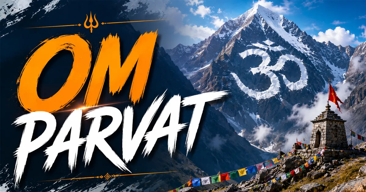
It is famous for one thing: this is the classic viewpoint where Om Parvat’s naturally formed “ॐ” snow pattern appears in near-perfect alignment. Many yatris call that first glimpse the most emotional moment of their Adi Kailash Yatra.
Quick Overview
Nabhidhang is the main Om Parvat viewpoint in the Vyas Valley, Pithoragarh (Uttarakhand), at roughly 4,300 m. It lies about 18 km from Gunji via Kalapani, needs an Inner Line Permit, and is best visited early morning in May–June and September–October.
Where Exactly Is Nabhidhang?
Nabhidhang (also written Nabidhang or Navidhang) lies on the Gunji–Lipulekh road of the Vyas Valley, near the India–Nepal–Tibet trijunction. En route sits Kalapani — regarded as the Kali River’s origin, with its historic Kali temple — a short drive before the viewpoint.
Don’t confuse Nabhidhang with Nabi village — Nabi is a residential Rung village where yatris stay overnight; Nabhidhang is the viewpoint you drive up to for darshan.
Why Nabhidhang Is Special
Om Parvat — approximately 5,590–5,900 m, as official sources themselves vary — carries an Om snow formation on its dark face, naturally shaped like “ॐ”.
- Geometry: From this high-altitude halt, the symbol appears crisp and unmistakable on clear days.
- Belief: Local Puranic tradition, cited on the Pithoragarh district tourism page, speaks of eight hidden natural Om symbols — this, by local belief, is the visible one.
- Setting: Cold-desert terrain along the Kali River, near the India–Nepal–China border region.
History & Significance of the Route
This is the historic Kailash Mansarovar Yatra corridor via Lipulekh Pass — pilgrims walked it from Dharchula for generations, until the BRO’s Lipulekh road (inaugurated 2020) replaced most of the trail. Kalapani’s Kali temple and Vyas Gufa keep its sacred character alive.
Best Time to Visit Nabhidhang
The best time to see Om Parvat from Nabhidhang is May–June and September–October, ideally early morning. Om visibility depends on weather and seasonal snow; monsoon months bring landslides and closures.
| Season | Months | Verdict |
|---|---|---|
| Pre-monsoon | May–June | Reliable visibility; peak rush |
| Monsoon | July–August | Avoid; clouds and landslides |
| Post-monsoon | Sept–Oct | Crisp views; colder mornings |
| Winter | Nov–April | Route largely inaccessible |
Early mornings generally offer the clearest views — which is why local drivers prefer leaving Gunji at first light.
Weather at Nabhidhang
Cold and windy even in season — sub-zero mornings are common and snow can arrive without warning. UV is harsh here; sunglasses and sunscreen matter as much as woollens.
How to Reach Nabhidhang
- Reach Kathgodam or Tanakpur — nearest railheads (~280–300 km from Dharchula); nearest airport Pantnagar.
- Drive to Dharchula — the last town with hotels, ATMs, fuel, and a hospital.
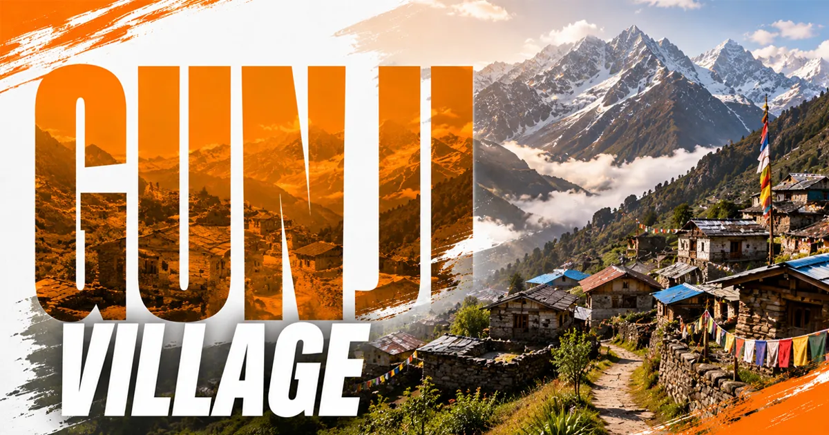
- Complete ILP formalities at Dharchula, then drive to Gunji or Nabi (~70–80 km) for an acclimatisation night.
- Gunji to Nabhidhang — the Gunji to Nabhidhang distance is approximately 18 km per the official Kailash Mansarovar Yatra itinerary, via Kalapani. The road is rough; use a high-ground-clearance local vehicle with an experienced driver.
Distance Chart (Approximate — verify current road status)
| Stretch | Distance | Time |
|---|---|---|
| Kathgodam → Dharchula | ~280–300 km | 9–10 hrs |
| Dharchula → Gunji/Nabi | ~70–80 km | 4–5 hrs |
| Gunji → Nabhidhang (via Kalapani) | ~18 km (official itinerary) | 1–1.5 hrs |
| Nabhidhang → Lipulekh Pass | onward road | subject to permission |
Road status: The border road has improved under the Border Roads Organisation, though landslides still occur — confirm conditions at Dharchula.
Nabhidhang Inner Line Permit
Nabhidhang lies in a restricted border zone, so an Inner Line Permit is mandatory. At the time of writing it is issued through the SDM office at Dharchula; registered operators routinely assist.
Commonly required: Aadhaar with copies, passport photos, and a high-altitude medical fitness certificate.
Entry rules for foreign nationals and OCI holders depend on current security regulations — verify before planning. Movement beyond Nabhidhang towards Lipulekh depends on army permission on the day.
Lipulekh Pass & Kailash Viewpoint (Optional Extension)
Beyond this border viewpoint, the road continues towards Lipulekh Pass (~5,100–5,350 m) on the India–Tibet border, subject to permissions. A further walk from the roadhead — conditions vary — leads to the Kailash viewpoint, where Mount Kailash is visible on clear days.
Access is tightly controlled by the army and ITBP; slots and viewing time can be limited. Treat it as a bonus, not a promise.
Where to Stay for Nabhidhang
No regular tourist accommodation exists at Nabhidhang. Yatris stay at Gunji, Nabi, or Napalchhu — community homestays or KMVN facilities — and make an early-morning round trip. Indicative cost: ₹1,000–1,500 per person per night with meals (approximate).
Nabhidhang vs Jolingkong
| Factor | Nabhidhang | Jolingkong |
|---|---|---|
| Main sight | Om Parvat “ॐ” | Adi Kailash & Parvati Sarovar |
| Base | Gunji/Nabi | Gunji/Nabi/Kuti |
| Terrain | Cold desert, border road | Alpine valley |
| Best light | Early morning | Morning |
Altitude Sickness & Safety
At roughly 4,300 m, oxygen is far thinner than the plains — acclimatize at Gunji or Nabi and keep the visit short. Watch for AMS symptoms (headache, nausea, breathlessness) and descend if they worsen; the nearest full hospital is at Dharchula.
Sample Itinerary (5–6 Days)
- Day 1: Kathgodam → Dharchula. Day 2: Permits; drive to Gunji/Nabi.
- Day 3: Early drive via Kalapani to Nabhidhang for darshan; return to base.
- Day 4: Jolingkong day trip for Adi Kailash. Day 5–6: Return via Dharchula, with a weather buffer day.
Connectivity, ATM & Fuel
Mobile connectivity is extremely limited in the valley — expect no network at the viewpoint itself. Withdraw cash and refuel at Dharchula; the valley has no ATMs or fuel pumps.
Budget Breakdown (Approximate, Per Person)
| Expense | Estimate |
|---|---|
| Kathgodam–Dharchula transport | ₹1,500–4,000 |
| Local vehicle in valley (shared) | ₹3,000–5,000 |
| Homestay + meals (per night) | ₹1,000–1,500 |
| Permit + documentation | ₹500–1,000 |
| Full packaged yatra (5–8 days) | ₹25,000–40,000 |
Check Posts, Drone Rules & Facilities
Documents are verified at ITBP/army check posts on the border road — keep your permit and ID accessible. Drones are effectively prohibited here, and photographing military installations is banned.
There are no restaurants or public toilets at the viewpoint — eat at your Gunji/Nabi homestay and carry water and dry snacks for the round trip.
Photography Tips
Reach around sunrise — the “ॐ” contrast is sharpest in first light. Use a zoom lens and keep batteries warm; cold drains them fast.
Common Mistakes to Avoid
- Skipping the acclimatisation night at Gunji/Nabi.
- Reaching the viewpoint late morning — and finding clouds.
- Confusing Nabhidhang with Nabi village.
- Assuming Lipulekh access is guaranteed.
- Planning travel in the July–August monsoon.
Responsible Tourism
Carry waste back, avoid single-use plastic, follow army instructions, and support local homestays — tourism income sustains the valley’s Rung families.
Final Word: Is Nabhidhang Worth It?
If Om Parvat darshan is on your heart, the honest answer is yes — Nabhidhang is why many pilgrims undertake this yatra. This sacred viewpoint rewards planning: acclimatize at Gunji or Nabi, start before dawn, keep a weather buffer.
Go in May–June or September–October, sort your ILP early at Dharchula, and travel with an experienced local driver. Do that, and — as many yatris say — the moment the “ॐ” appears stays with them for life.
Frequently Asked Questions
What is Nabhidhang famous for?
The classic viewpoint for Om Parvat’s natural “ॐ” snow formation, on the Lipulekh route in the Vyas Valley.
What is the Nabhidhang altitude?
Approximately 4,300 metres (~14,100 ft); acclimatize at Gunji or Nabi before visiting.
How far is Gunji to Nabhidhang?
Approximately 18 km via Kalapani, per the official Kailash Mansarovar Yatra itinerary — about 1–1.5 hours.
Do I need a permit for Nabhidhang?
Yes — an Inner Line Permit issued at Dharchula, checked at army posts en route.
What is the best time to see Om Parvat from Nabhidhang?
Early morning, May–June and September–October. Visibility depends on weather and seasonal snow conditions.
Can I stay overnight at Nabhidhang?
No regular tourist stays — yatris stay at Gunji, Nabi, or Napalchhu and make a morning round trip.
Is Nabhidhang accessible by road?
Yes, the viewpoint is reachable by road in season; no long trek is required.
What is Kalapani en route?
Kalapani is regarded as the Kali River’s origin and hosts a historic Kali temple; most groups stop for darshan.
Can I see Mount Kailash from Nabhidhang?
No — Mount Kailash is viewed from the Lipulekh Pass viewpoint further ahead, subject to army permission.
Can foreigners visit Nabhidhang?
Entry for foreign nationals and OCI holders depends on current security regulations — verify with the administration.
Nabhidhang vs Jolingkong — what’s the difference?
Nabhidhang gives Om Parvat darshan; Jolingkong is the Adi Kailash base. Most itineraries cover both.
Is mobile network available at Nabhidhang?
Connectivity is extremely limited in the valley; expect no signal at the viewpoint itself.
Is Nabhidhang safe for senior citizens?
Road access helps, but the altitude is serious — medical fitness, acclimatisation, and short visits are essential.
What if the Om is not visible?
Clouds can hide it — keep a buffer day. Early-morning attempts have the best odds.
How many days does a Nabhidhang trip take?
Plan 5–6 days from Kathgodam, covering permits, acclimatisation, darshan, and a weather buffer.
How is the weather at Nabhidhang?
Cold and windy year-round; sub-zero mornings are common even in season, and snow can arrive suddenly.
Are drones allowed at Nabhidhang?
No — it’s a sensitive border area; drones are effectively prohibited and military photography is banned.
Are food and toilets available at the viewpoint?
No — facilities exist only at base villages like Gunji and Nabi; carry water and dry snacks.
Request a customised travel plan from the Namaste India Trip team.





Share your experience, ask a question, or leave useful tips for other travelers.